The Earth in Flux Chart Gallery
A shared initiative between the USGS Water Mission Area and Ecosystems Mission Area to communicate key findings of USGS land change science in innovative ways, and to encourage creativity, exploration, and community in data visualization.
The Powerhouse of USGS Paleo-research
The USGS is home to one of the largest, most multidisciplinary groups of scientists who unravel mysteries of the past, and help project future patterns, by studying paleoclimate.
Coring Expedition to Palmyra Atoll
Helping managers understand pre-human vegetation, climate variability, and sea level changes
National News Release: Study confirms age of oldest fossil human footprints in North America
Two new lines of evidence support the 21,000 to 23,000-year age estimate of the footprints first described and dated in 2021
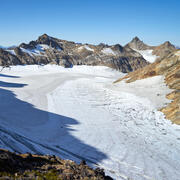
The Glacier - Climate Connection
The story of the U.S. Geological Survey Benchmark Glacier Project, one of the longest running studies of glaciers on Earth
The National Climate Change Viewer (NCCV)
A tool that helps land managers and decision makers plan for climate change
Ecosystems Land Change Science Program
The Land Change Science Program in the USGS Ecosystems Mission Area strives to advance the understanding of the physical, chemical, and biological components of the Earth system, the causes and consequences of climate and land use change, and the vulnerability and resilience of the Earth system to such changes.


